Press Release: New Public Resource to Assist Limestone Conservation Efforts in Malaysia

Limestone outcrops in Kedah, Malaysia

Kuala Lumpur, 2 September 2021 – Researchers have just released a publicly accessible online resource that contains the most comprehensive information on Malaysia’s limestone hills to date. Containing detailed maps, photos, and data in the form of 7 separate eBooks, the resource is titled ‘Conservation of Limestone Ecosystems of Malaysia’.

Limestone hills harbour unique biodiversity and provide numerous ecosystem services to humans, but face intensifying disturbances from forest loss, agricultural expansion, and infrastructure development. In the National Policy of Biological Diversity 2016-2025, the protection and restoration of limestone ecosystems are listed as one of the 17 national biodiversity targets.

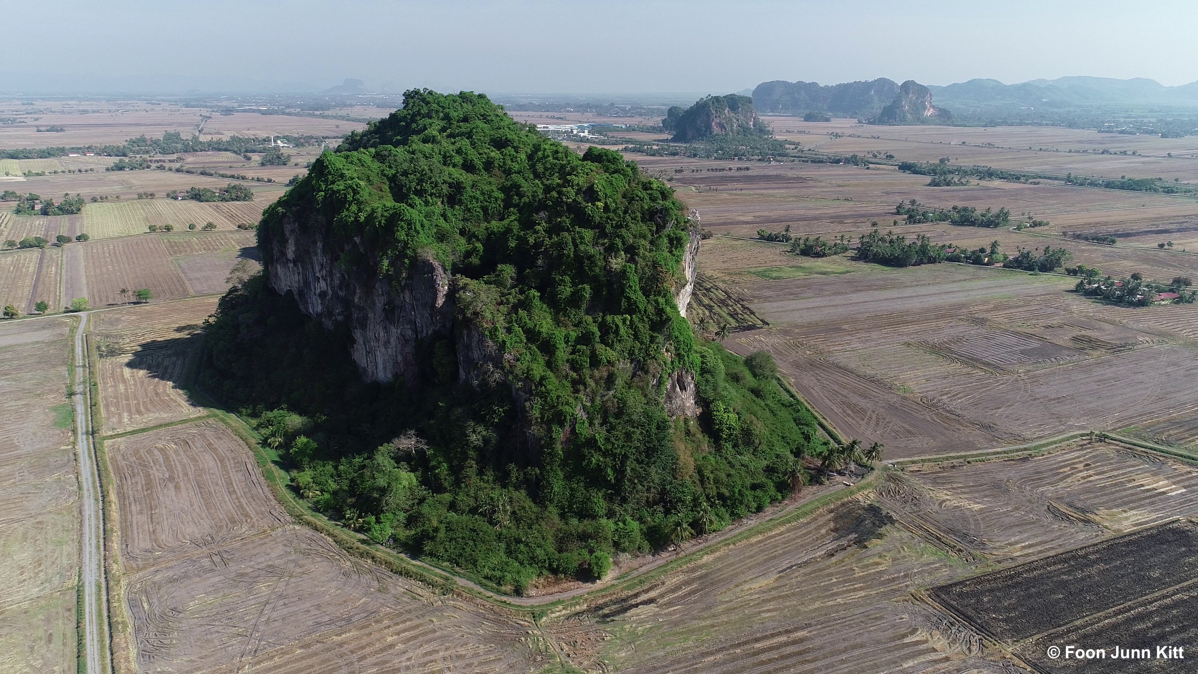
In order to find out which limestone hills warrant urgent protection, a team of researchers felt the need to create a public database that includes information on their location, biodiversity, surrounding land use and extent of habitat disturbance.

With the help of satellite images, drone technology and ground verification, researchers have now accurately mapped 1393 limestone hills in Malaysia, with 911 located in Peninsular Malaysia, and 482 in Malaysian Borneo.

“After two years of analysis, compiling information, and travelling more than 22,000 km, I think we now have an almost complete picture of how Malaysia’s limestone hills are doing.” said Foon Junn Kitt, Project Coordinator of Rimba’s Project Limestone, who led the intensive field surveys.

Continue reading
Advertisement

Toolbox update 7: How to use Peninsular Malaysia’s first online map of limestone hills

For many years, scientists in Project Limestone have been frustrated by the lack of GIS information on limestone hills in Malaysia.  Till now, information on localities, shapes and sizes could only be obtained from books and journals, but not anymore…

Thanks to Liew and the team, Rimba has created Peninsular Malaysia’s first online map containing 445 hills.  This GIS map can easily be accessed by anyone who has Google Earth. This map is not a final product, but can be constantly improved by anyone who wants to add spatial or biological information on limestone hills. All the methods and data are available for anyone to reuse, revise, remix and redistribute.

With this map, we were finally able to conduct a simple conservation prioritisation exercise for limestone hills based on their size and the degree to which they are isolated and disturbed.

You can find our paper published here in the journal Tropical Conservation Science. Meanwhile, here are videos that explain the methodology, and how to update and use this map!


Rimba comments on the fate of limestone karsts in Pahang

Ever wonder what can happen to majestic limestone karsts like these in Malaysia?

Pristine limestone karsts, Bau, Sarawak. ©Rimba/Reuben

Good Times recently featured a story on the sad fate of the Panching limestone karsts in Pahang, Malaysia, and Rimba reseachers Reuben and Liew gave their two cents worth. You can read the article here.

Most of these karsts were formed millions of years ago and are now home to many endemic plants and animals. This review paper will tell just how special and imperiled these ecosystems are.

As our mission statement says, Rimba is not against economic pursuits such as limestone quarrying, but certain groups of karsts that have been isolated for millions of years should be spared from quarrying as they are likely to support many biologically unique organisms. Here’s another paper that talks about the factors that should be considered when companies are deciding on which karsts to quarry. It’s time to use science to make smart decisions and avoid losing very special organisms that the world  will never see again.