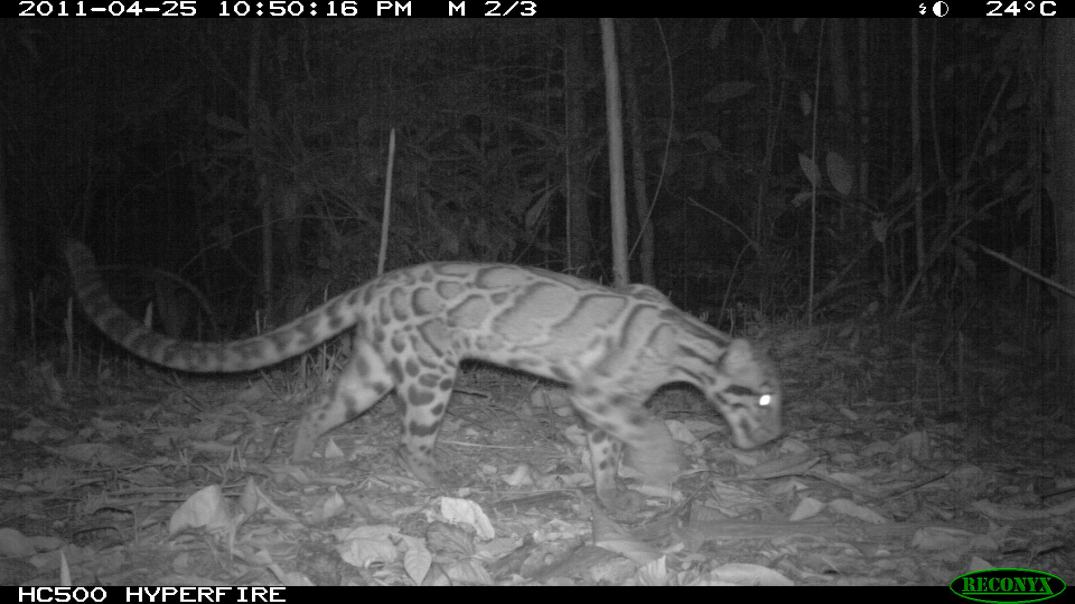
Here’s a long overdue photo update on the species of mammals photographed by our Reconyx camera traps in the Kenyir Wildlife Corridor Project.
While other camera traps used by our friends in WWF-Malaysia have flash that captures award-winning photos of wildlife and allow you to identify animal individuals to get density estimates, covert cameras such as ours may decrease the likelihood of your camera being destroyed by irritable elephants or encroachers who want souvenirs – it all depends on the objective of your study. In this project, we are mainly interested to know the species present in the forests and the species utilising viaducts over fixed time periods.
Fortunately, these camera traps are password-protected and have built-in cameras that would be of no use to a thief. Our cameras have been out for 3 months in the forests and we are happy to report the cameras retrieved so far were healthy and dry. Here are photos of several interesting species recorded from the forests and beneath the viaducts. Enjoy!
Interesting mammals recorded in forests

For the rest of the photos… Continue reading
 Over the years, scientists have developed a range of species distribution models (SDMs) to help you do just that. SDMs try to establish a relationship between your species records and the environmental or spatial characteristics (e.g., rainfall, temperature, forest cover, land use types, distance to water sources) of your sampling area (Franklin 2009). In other words, SDMs help to predict where you might find other suitable habitats for your species – you don’t always have to depend on luck to go find them! One of the more popular types of SDMs is Maximum Entropy Modelling